In order to provide tourists and locals the chance to learn more about North Carolina’s history, geography, and culture while also promoting the conservation and preservation of these resources, the N.C. Department of Transportation has designated 54 beautiful byways. The routes are carefully chosen to represent the Tar Heel State’s varied natural beauty and cultural heritage and to provide passengers with a secure and enjoyable detour.
List of 5 Scenic Drives in the Boone Area
U.S. Highway 64 from Hendersonville to Murphy
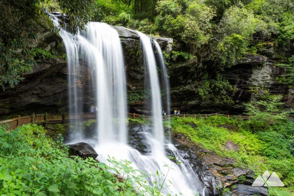
The communities of Brevard, Rosman, Lake Toxaway, Sapphire, Cashiers, Highlands, and Franklin will be passed through on this route. Brevard is well-known for hosting an acclaimed yearly music festival. One of the highest cities east of the Mississippi River, Highlands is tucked away in a valley at 4,118 feet. Its core city is pedestrian-friendly and boasts a variety of good places to dine and shop. The biggest town along this route is Franklin. Check out the numerous day hikes, waterfalls, and breathtaking scenery along this route. Between Cashiers and Highlands, a popular walk is Whiteside Mountain.
U.S. Highway 129 from Nantahala to Tennessee
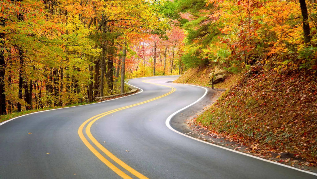
From U.S. Highway 74, this path begins in the Nantahala Gorge. This road sometimes referred to as the “Tail of the Dragon,” is well-liked by motorcycle aficionados. Everyone will enjoy the breathtaking vistas along the journey, though. The route goes by Lake Santeetlah, through Deals Gap, along the southern edge of the Great Smoky Mountains National Park, and then into Tennessee. From the town of Robbinsville, motorists can also access the Cherohala Skyway, another breathtaking drive that starts in Robbinsville and ends in Tellico Plains, Tennessee. Beyond Deals Gap, known as the “Tail of the Dragon,” there is minimal development and an estimated 318 turns.
Blue Ridge Parkway South from Asheville to Great Smoky Mountains National Park
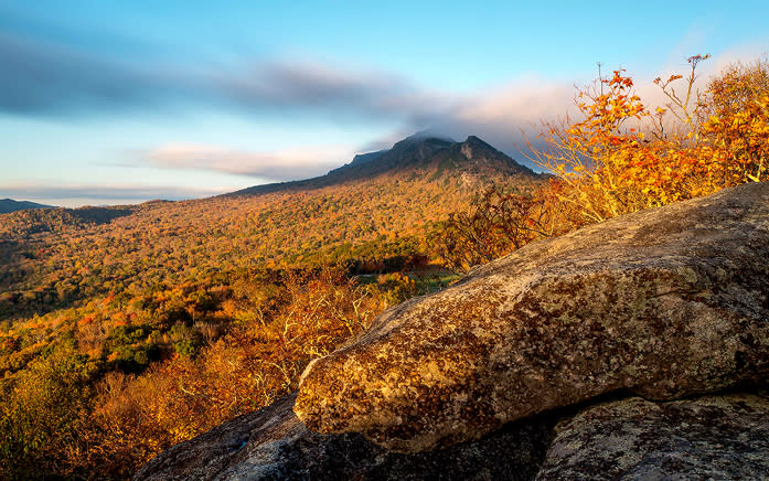
Some of the highest heights throughout the whole length of the Blue Ridge Parkway may be found in this area. The route’s upper altitudes take drivers through evergreen spruce-fir woods and provide spectacular views of the surrounding mountain range. The Shining Rock Wilderness offers dramatic backcountry hiking and camping opportunities. Other highlights of this drive include Devil’s Courthouse (a two-mile roundtrip hike from the parking lot), Richland Balsam (the parkway’s highest point at 6,053 feet), and Waterrock Knob. Mt. Pisgah is a three-mile roundtrip hike from the parking lot. The Great Smoky Mountains National Park’s southern entrance is where the parkway comes to an end, next to the Oconoluftee Visitor Center.
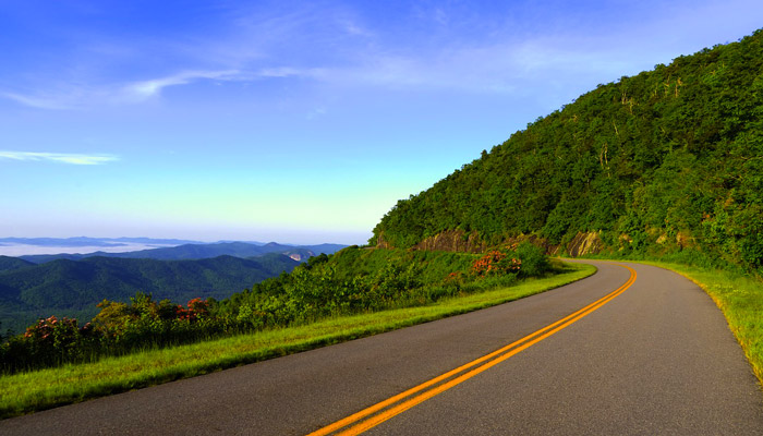
Blue Ridge Parkway North from Asheville to Virginia
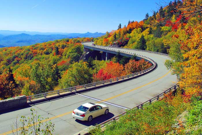
This section of the Blue Ridge Parkway also contains some spectacular scenery and access to some high peaks. The Folk Art Center, Craggy Gardens, Little Switzerland, Museum of North Carolina Minerals, Linville Falls and Linville Gorge, Linn Cove Viaduct and Grandfather Mountain, Boone, Blowing Rock, Julian Price Memorial Park, Moses H. Cone Memorial Park, access to Mount Mitchell State Park, and Roan Mount are some of the highlights of this section of the parkway. Mount Mitchell is the highest peak in the eastern United States east of the Mississippi River at 6,684 feet.
U.S. Highway 441 from Cherokee to Tennessee through Great Smoky Mountains National Park
Although a little touristic, the nearby town of Cherokee offers some fascinating information on the Cherokee culture of the area. Visit the Oconaluftee Visitor Center after entering the Great Smoky Mountains National Park to view local history displays, such as the mountain farm exhibit, and learn more about the country’s most popular national park.
The path continues through the park, following the Oconaluftee River, before beginning to ascend to Newfound Gap on the North Carolina/Tennessee border. Along the journey, there are several viewpoints and a few little walks. Visitors can ascend to Clingman’s Dome, the park’s highest peak at 6,643 feet, via a side route (closed in winter).
Park at Newfound Gap (5,046 feet above sea level) and enjoy the breathtaking views to the north and south. From Newfound Gap, you might choose to take a little stroll either way along the Appalachian Trail. Some breathtaking views may be found along the route that leads east from the gap. From Newfound Gap, you may travel farther into the Tennessee side of the park, where there are additional breathtaking views and treks. U.S. 441 will eventually take you into Gatlinburg, which is located just outside the national park to the north.